


DJI Enterprise
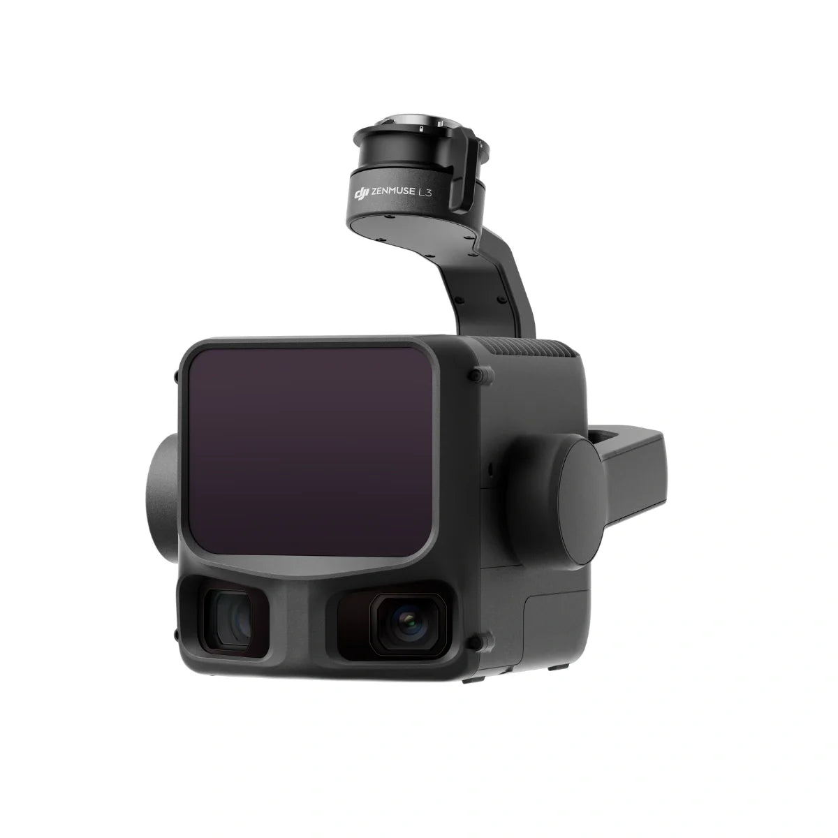
DJI Zenmuse L3 Camera
Enterprise pricing, payment terms and bulk orders. Talk to a drone specialist.
The DJI Zenmuse L3 is DJI's long-range LiDAR and RGB survey payload, built exclusively for the Matrice 400 (it mounts through the Zenmuse L3 single gimbal connector). Its laser runs at 100, 350, 1,000 or 2,000 kHz, reaches 700 m at 10% reflectivity and 2,000 m at 80%, and records up to 16 returns per pulse at the lower frequencies, so it captures true ground under dense canopy that photogrammetry never sees. A co-mounted 100MP 4/3 CMOS RGB camera colorizes the point cloud and produces true orthophotos in the same pass. DJI publishes 3 cm RMSE vertical accuracy at 120 m and 5 cm at 300 m flight altitude.
DJI Zenmuse L3 Specs
| Spec | Value |
|---|---|
| Laser Pulse Frequency | 100 kHz, 350 kHz, 1,000 kHz, 2,000 kHz |
| Detection Range | 700 m at 10% reflectivity (350 kHz); 2,000 m at 80% reflectivity (100 kHz) |
| LiDAR Returns | 4, 8 or 16 returns at 100 kHz and 350 kHz; fewer at higher frequencies |
| RGB Camera | 100MP, 4/3 CMOS |
| Point Cloud Vertical Accuracy | 3 cm RMSE at 120 m; 5 cm RMSE at 300 m |
| Weight | 1.60 kg (without single gimbal connector) |
| IP Rating | IP54 |
| Compatible Aircraft | DJI Matrice 400 (requires the Zenmuse L3 single gimbal connector) |
| Processing Software | DJI Terra (native) |
Specifications verified against DJI's published Zenmuse L3 specs, September 2026.
Use Cases
- Topographic Mapping — High-density point clouds and DTM/DSM for land development and civil engineering
- Corridor Surveying — Power lines, pipelines, roads, and railways, with the 700 m range allowing higher flight lines and fewer passes
- Forestry & Canopy Analysis — Up to 16 returns capture both canopy top and ground surface for tree height and biomass
- Construction Monitoring — Earthwork volumes, grade verification, and BIM progress tracking
Related Resources
- Zenmuse L3 survey workflow: a working surveyor's full field-to-CAD process, with video
- Zenmuse L3 forestry and plantation mapping: 3,800 hectares in two days
- Zenmuse L3 vs L2: what changed, and why the L2 is now discontinued
- DJI Matrice 400 RTK Payloads Guide — H30T, L3, P1, V1 and S1 compared
- Zenmuse P1 — pair with the L3 for simultaneous LiDAR and photogrammetry on the M400 dual gimbal
- Zenmuse H30T — 5-sensor thermal payload, pairs with the L3 on the M400 dual gimbal
- DJI Matrice 400 RTK — the compatible aircraft for the Zenmuse L3
Ships from the USA
Pairs well with
Contact us for current lead time.
Covered by DJI's manufacturer warranty. View warranty details

LiDAR per pulse

Detection range

LiDAR point rate

4/3 CMOS RGB

H/V accuracy
If you have any questions, you are always welcome to contact us. We'll get back to you as soon as possible, within 24 hours on weekdays.
-
Shipping Information
We ship from the United States. Many enterprise items are drop-shipped from the manufacturer or distributor, so contact us for the current lead time on your configuration before you order.
-
Customer Support
You deal directly with Global Drone HQ, not a call center queue. Send over your configuration, compliance, or integration questions and you will get a straight answer.
-
FAQ’s
Have a question this page does not cover? Ask us. That includes anything you need for a purchase order, bid package, or internal approval.
-
Contact Us
Email daniel@globaldronehq.com for quotes and product questions. We accept purchase orders, ACH, and wire transfer for agencies and businesses. Payment is required up front.

See Through, Far and True
Accuracy meets efficiency
Dual 100MP RGB Mapping Camera System
High Accuracy, High Penetration
High-Precision LiDAR Mapping, Built for Real-World Accuracy
The DJI Zenmuse L3 combines high-performance LiDAR, an integrated RGB camera, and RTK precision to deliver accurate, high-density point clouds in a single flight. Designed for surveying, mapping, and infrastructure modeling, it enables faster data capture with reliable, repeatable results.


High-Density LiDAR Mapping for Real-World Terrain
Capture highly accurate 3D point clouds across complex environments with the Zenmuse L3. From open terrain to dense vegetation, its advanced LiDAR system delivers detailed elevation data and structure mapping - reducing field time while improving accuracy.


Survey-Grade Accuracy, Built In
With integrated RTK positioning and high-precision IMU data, the Zenmuse L3 delivers centimeter-level accuracy without relying heavily on ground control points. Generate reliable, repeatable datasets for surveying, construction, and infrastructure projects with confidence.


Faster Data Capture, Maximum Coverage
The Zenmuse L3 enables efficient large-area mapping with high point cloud density and extended detection range. Capture more data in fewer flights, streamline workflows, and reduce operational costs - without sacrificing detail or accuracy.
DJI Zenmuse L3: Everything You Need To Know
Explore how the Zenmuse L3 combines high-precision LiDAR with dual 100MP RGB cameras to deliver faster, more accurate mapping. This walkthrough covers performance, data capture workflows, and how to deploy the L3 for real-world surveying operations.
Tech Specs
Key Specifications
- Point Cloud Rate: Up to ~240,000 pts/sec
- Detection Range: Up to ~450 m (varies by reflectivity)
- Accuracy: Centimeter-level with RTK positioning
- Sensor Type: Integrated LiDAR + RGB camera system
- Supported Aircraft: DJI Matrice 300 RTK / 350 RTK / 400 RTK
- Data Output: High-density point clouds with RGB colorization
- Workflow Integration: Compatible with DJI Terra for processing and modeling
Imaging & Payload Capabilities
- LiDAR Scanning: High-density point cloud capture for precise terrain and structure mapping
- RGB Camera: Integrated imaging for colorized point clouds and enhanced visualization
- Vegetation Penetration: Capture accurate ground elevation beneath canopy
- 3D Modeling: Ideal for generating detailed terrain and structural models
- Multi-Return Capability: Improved data capture in complex environments
Performance & Flight Intelligence
- RTK Positioning: Enables survey-grade accuracy with reduced reliance on GCPs
- Direct Georeferencing: Streamlined workflows with precise spatial data
- Efficient Coverage: Capture large areas in fewer flights compared to traditional methods
- Seamless Integration: Works within DJI ecosystem for mission planning and data processing
- Repeatable Missions: Consistent and reliable data capture across multiple flights
Use Cases & Applications
- Surveying & Topographic Mapping
- Construction & Site Development
- Power Line & Infrastructure Inspection
- Forestry & Vegetation Analysis
- Mining & Stockpile Measurement
- Corridor Mapping (roads, pipelines, rail)
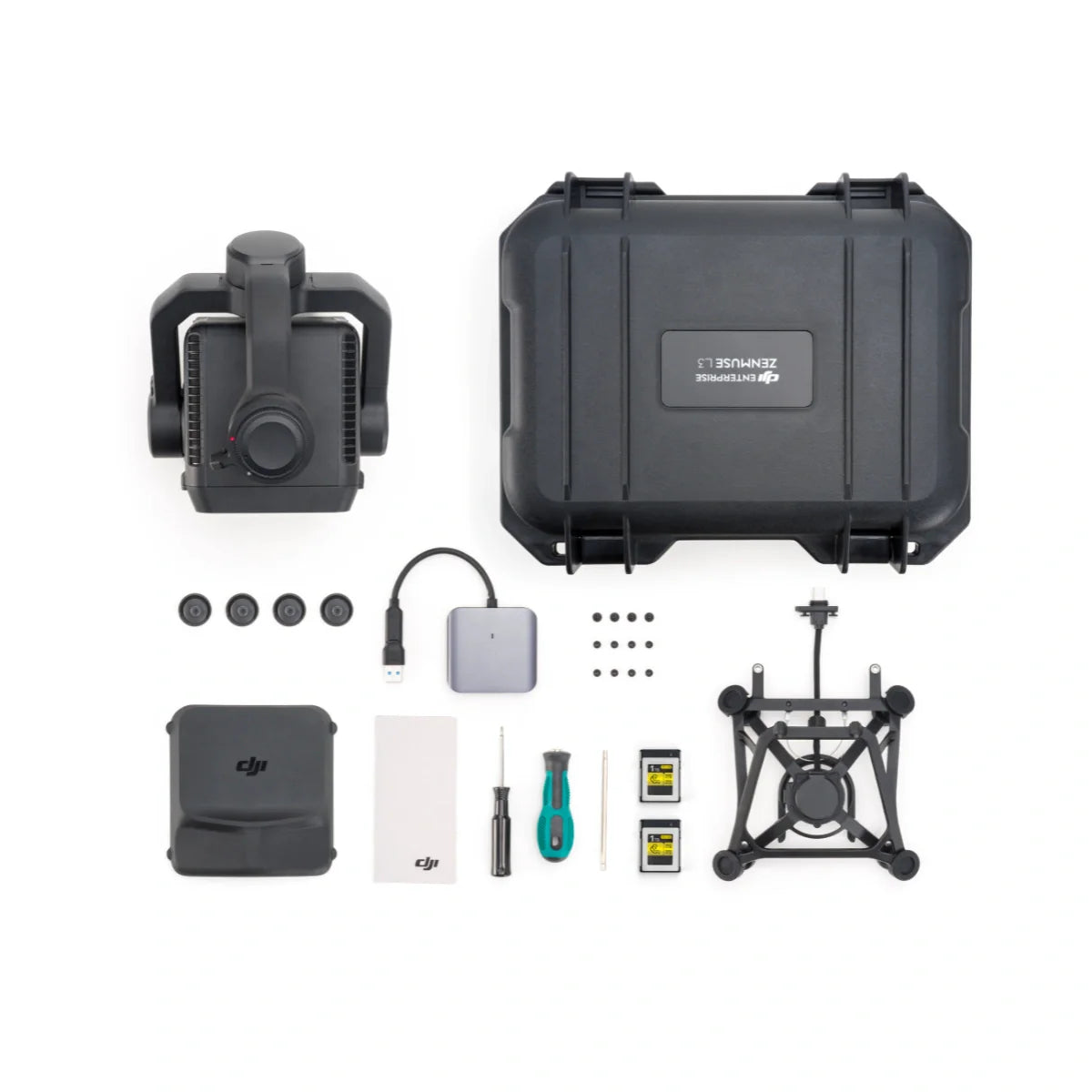
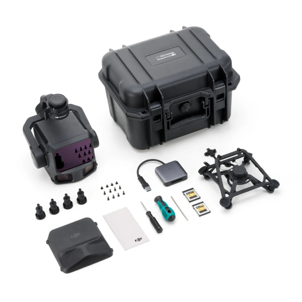
Included in the Box
DJI Zenmuse L3 LiDAR Gimbal Camera
Single Gimbal Connector
CFexpress Type-B Card Reader
Storage Case
Lens Cleaning Cloth
Matrice 400 Carrying Case Insert
Screws and Tools
4x Gimbal DamperLens Cap
Zemuse L3 User Manual
FAQs
What is the Zenmuse L3 used for?
The Zenmuse L3 is used for high-precision LiDAR mapping, including surveying, terrain modeling, construction planning, and infrastructure inspection.
What makes the L3 different from traditional mapping methods?
Unlike photogrammetry alone, LiDAR can penetrate vegetation and capture accurate ground elevation data, making it ideal for dense or complex environments.
What drones is the Zenmuse L3 compatible with?
The L3 is compatible with DJI Matrice 300 RTK, Matrice 350 RTK, and Matrice 400 RTK platforms.
How accurate is the Zenmuse L3?
With RTK enabled, the L3 delivers centimeter-level accuracy, making it suitable for professional surveying and mapping applications.
Can the L3 be used in forested or vegetated areas?
Yes. LiDAR technology allows the L3 to penetrate vegetation and capture accurate ground data beneath tree cover.
Does the L3 require ground control points (GCPs)?
While GCPs can improve accuracy, the L3’s RTK capabilities reduce the need for them in many workflows.
What software is used to process L3 data?
The L3 integrates with DJI Terra for point cloud processing, modeling, and analysis.
Is this system suitable for construction projects?
Absolutely. It is widely used for site mapping, volumetric analysis, and progress tracking.