

DJI Enterprise
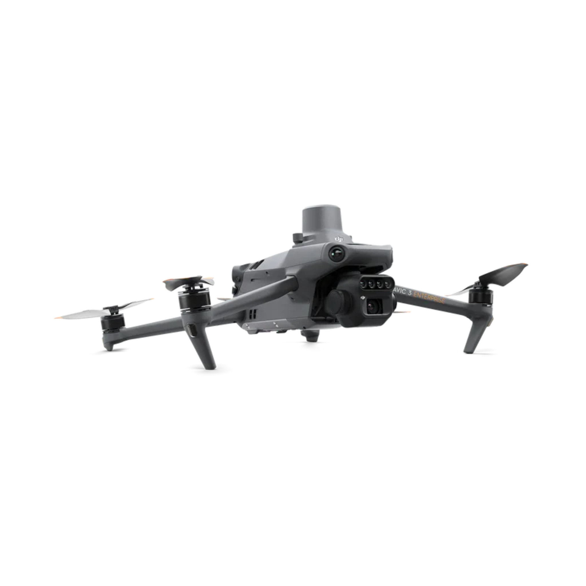
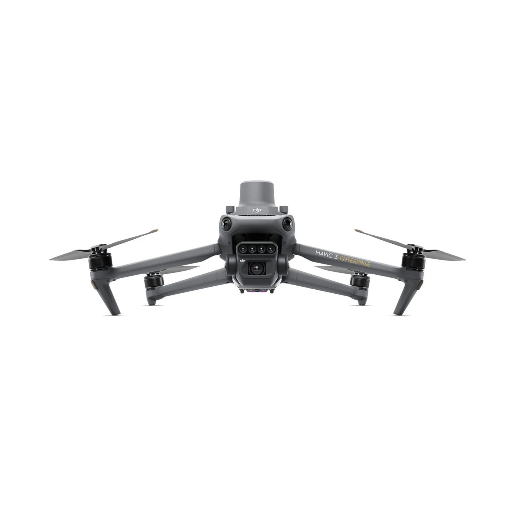
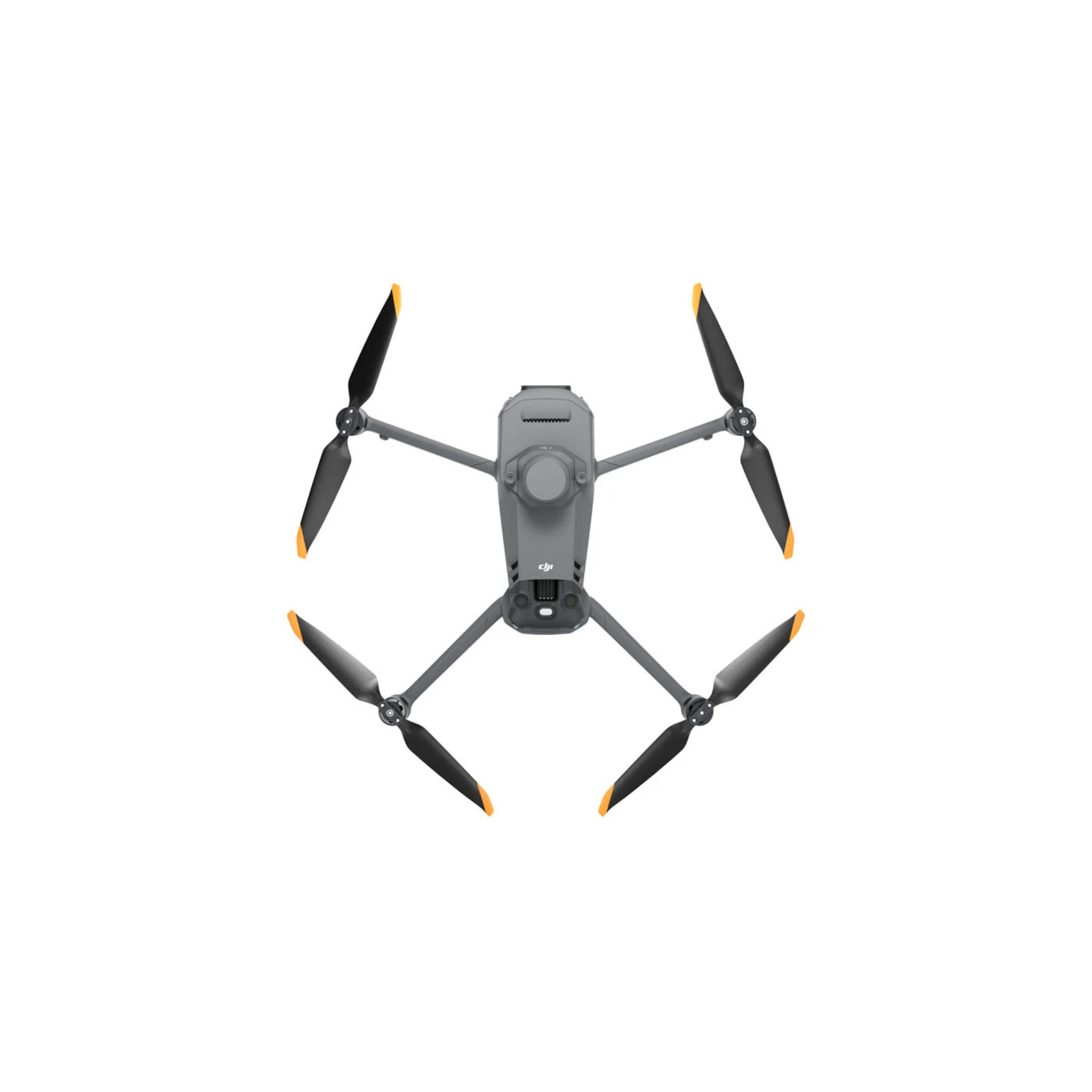
DJI Mavic 3 Multispectral Drone
Enterprise pricing, payment terms and bulk orders. Talk to a drone specialist.
The DJI Mavic 3 Multispectral is built for agronomists, precision agriculture consultants, and environmental scientists who need calibrated multispectral data in a platform that fits in a backpack. Unlike standard RGB mapping drones, the M3M captures five spectral bands simultaneously, including near-infrared wavelengths that reveal crop stress, nutrient deficiencies, and disease outbreaks weeks before they become visible to the naked eye. Built-in RTK delivers centimeter-level positioning without a ground station, and the DLS 2 downwelling light sensor applies real-time irradiance correction to every frame so your NDVI data is scientifically consistent regardless of cloud cover or solar angle changes during the flight.
The M3M shares the same proven airframe as the Mavic 3 Enterprise and Mavic 3 Thermal -- 43 minutes of flight time, 15 km O3 Enterprise transmission range, omnidirectional obstacle avoidance, and IP43 weather resistance. One operator can survey 200 hectares in a single flight at 120m AGL, then bring the data into DJI Terra Pro for multispectral orthomosaic and NDVI map generation without leaving the field.
DJI Mavic 3 Multispectral Specifications
| Specification | Detail |
|---|---|
| Price | $5,729 |
| RGB Camera | 4/3" CMOS, 20MP, mechanical shutter, f/2.8-f/11 |
| Multispectral Cameras | 5 x 5MP sensors, 1/2.9" CMOS, global shutter |
| Spectral Bands | Blue (450 nm), Green (560 nm), Red (650 nm), Red Edge (730 nm), NIR (840 nm) |
| RTK Module | Built-in, centimeter-level accuracy -- supports D-RTK 2 and RTK Network |
| DLS 2 Sensor | Built-in downwelling light sensor for real-time irradiance correction |
| Coverage per Flight | Up to 200 hectares at 120m AGL |
| Max Flight Time | 43 minutes |
| Transmission Range | 15 km (O3 Enterprise) |
| Obstacle Avoidance | Omnidirectional (forward, backward, lateral, upward, downward) |
| Wind Resistance | 12 m/s (Level 6) |
| IP Rating | IP43 (light rain and dust resistant) |
| Takeoff Weight | 951g |
| Max Speed | 75 km/h (Sport mode) |
| Operating Temperature | -10°C to 40°C |
| Software | DJI Pilot 2, DJI Terra Pro, DJI FlightHub 2 |
What the Mavic 3M Is Used For
Crop Health Mapping and NDVI Analysis
The M3M's primary use case is generating vegetation index maps (NDVI, NDRE, GNDVI) across agricultural fields. The five-band sensor captures near-infrared reflectance data that reveals crop stress, nitrogen deficiency, fungal disease, and irrigation failures weeks before symptoms are visible to the human eye. Agronomists use these maps to identify problem zones for targeted intervention, reducing fertilizer and pesticide inputs while protecting yield. A single 43-minute flight at 120m AGL covers 200 hectares -- enough for a large commercial farm in one session.
Variable Rate Application Prescriptions
Processed through DJI Terra Pro or third-party platforms such as Pix4Dfields, M3M flight data generates georeferenced prescription maps that drive variable-rate fertilizer and pesticide application equipment. The built-in RTK module provides centimeter-level positioning accuracy, ensuring prescription zones align precisely with physical field boundaries and row patterns -- eliminating the GPS offset errors that reduce the value of conventional survey drone outputs.
Environmental Monitoring and Research
Beyond agriculture, the M3M is used for wetland health assessment, forestry canopy analysis, invasive species detection, and land reclamation monitoring. NIR reflectance data reliably distinguishes healthy vegetation from stressed or dead plant matter across any ecosystem. Research institutions and environmental consultants use the M3M for longitudinal vegetation studies that require repeatable, radiometrically calibrated spectral data across multiple flights over time.
Irrigation and Field Management
Regular M3M overflights produce time-series vegetation index maps that identify irrigation uniformity issues, failing drip emitters, and waterlogged zones before root damage occurs. At 200 hectares per flight, routine weekly monitoring is operationally practical even on large row-crop operations.
How Multispectral Imaging Works
Standard cameras capture red, green, and blue light -- the same visible spectrum the human eye uses. Multispectral cameras add bands beyond visible light, particularly near-infrared (NIR). Healthy green plants reflect NIR strongly because chlorophyll in living cells redirects short-wave infrared energy. Stressed, diseased, or dying vegetation reflects significantly less NIR. NDVI (Normalized Difference Vegetation Index) quantifies this relationship: NDVI = (NIR - Red) / (NIR + Red). Values near 1.0 indicate dense healthy vegetation; values near 0 indicate bare soil or severely stressed crops.
The M3M's DLS 2 (Downwelling Light Sensor) is essential for repeatable results. Ambient light intensity changes constantly during a flight as clouds pass and the solar angle shifts. Without irradiance correction, the same field flown at 9am and 11am would produce different NDVI values driven purely by lighting conditions rather than actual plant health. The DLS 2 measures incoming light continuously and applies real-time correction factors to every captured frame, ensuring data consistency across flights, dates, and weather conditions.
How the Mavic 3M Compares
| Spec | DJI Mavic 3M -- $5,729 | DJI P4 Multispectral (discontinued) |
|---|---|---|
| Multispectral Resolution | 5MP per band | 2MP per band |
| RGB Camera | 4/3" CMOS, 20MP, mech. shutter | 1/2.4" CMOS, 2MP, global shutter |
| RTK | Built-in | External (D-RTK 2 add-on) |
| Irradiance Correction | DLS 2 (built-in) | DLS (built-in) |
| Max Flight Time | 43 min | 27 min |
| Coverage per Flight | 200 ha at 120m AGL | ~100 ha at 120m AGL |
| Transmission Range | 15 km (O3 Enterprise) | 7 km (OcuSync 3) |
| Obstacle Avoidance | Omnidirectional | Forward + downward only |
| Takeoff Weight | 951g | 1487g |
Need a payload-based multispectral solution for larger operations or dual-sensor workflows? The MicaSense RedEdge-P and MicaSense Altum-PT Kit are available for M300/M350 RTK integration.
Related Products
DJI Matrice 30 Enterprise → MicaSense RedEdge-P Camera → MicaSense Altum-PT Kit → MicaSense RedEdge-P Dual Kit →
Frequently Asked Questions
What is the DJI Mavic 3 Multispectral price?
The DJI Mavic 3 Multispectral is priced at $5,729 at Global Drone HQ. This includes the drone, one intelligent flight battery, RC Pro Enterprise controller, and standard accessories. Ships from the US with full DJI manufacturer warranty coverage.
How is the M3M different from a regular mapping drone?
A standard mapping drone captures red, green, and blue light -- the same visible range the human eye sees. The M3M also captures Red Edge and Near-Infrared bands that are invisible to the eye but carry critical information about plant physiology. This makes the M3M capable of detecting crop stress, nutrient deficiencies, and disease before visual symptoms appear. For agricultural applications, the difference in actionable data quality is substantial.
What vegetation indices can the M3M produce?
The five-band sensor supports calculation of NDVI (Normalized Difference Vegetation Index), NDRE (Normalized Difference Red Edge Index), GNDVI (Green NDVI), SAVI (Soil-Adjusted Vegetation Index), and other standard vegetation indices used in precision agriculture. DJI Terra Pro generates NDVI and NDRE orthomosaics natively. Third-party platforms including Pix4Dfields, AgEagle FieldAgent, and QGIS support additional indices from the raw reflectance data.
Do I need DJI Terra to process M3M data?
DJI Terra Pro is the recommended processing workflow for M3M data and is tightly integrated with the aircraft's flight planning and data format. That said, the M3M outputs industry-standard TIFF files with embedded calibration metadata, making it compatible with Pix4Dfields, Agisoft Metashape, AgEagle FieldAgent, and other professional photogrammetry and agriculture analytics platforms.
Does the M3M require ground control points (GCPs)?
The built-in RTK module provides centimeter-level absolute accuracy in both horizontal and vertical positioning, which eliminates the need for GCPs for most agricultural mapping applications. For surveys requiring absolute accuracy verification (research, legal boundary mapping, or integration with high-precision GIS layers), GCPs are still recommended as a validation check rather than a primary positioning input.
What is the minimum flight altitude for M3M mapping?
The M3M can be flown at virtually any altitude above the minimum obstacle avoidance range. For multispectral agriculture mapping, 60m-120m AGL is the standard range. Flying at 60m delivers higher spatial resolution (approximately 3.3 cm/pixel for the multispectral bands) useful for row-crop analysis, while 120m maximizes coverage at 200 hectares per flight for large-area surveys where per-pixel resolution is less critical.
Questions About the Mavic 3 Multispectral?
Our team can help you match the right multispectral platform to your operation -- whether you're mapping a 50-hectare specialty crop or monitoring thousands of acres across multiple sites.
Talk to a Specialist → Browse Mapping Drones
Recommended Accessories
Ships from the United States. Contact us for current lead time.
Covered by DJI's manufacturer warranty. View warranty details

Multispectral sensors

Max flight time
Coverage per flight

Centimeter accuracy

4/3 RGB camera
DJI Mavic 3 Multispectral Drone
If you have any questions, you are always welcome to contact us. We'll get back to you as soon as possible, within 24 hours on weekdays.
-
Shipping Information
We ship from the United States. Many enterprise items are drop-shipped from the manufacturer or distributor, so contact us for the current lead time on your configuration before you order.
-
Customer Support
You deal directly with Global Drone HQ, not a call center queue. Send over your configuration, compliance, or integration questions and you will get a straight answer.
-
FAQ’s
Have a question this page does not cover? Ask us. That includes anything you need for a purchase order, bid package, or internal approval.
-
Contact Us
Email daniel@globaldronehq.com for quotes and product questions. We accept purchase orders, ACH, and wire transfer for agencies and businesses. Payment is required up front.


Your Everyday Commercial Drone
Compact and Portable
Three Models, Countless Applications
Premium Camera Performance
Built for Payloads. Ready for Any Mission.
The DJI Matrice 400 is a next-generation enterprise drone platform designed for complex operations across public safety, inspection, and industrial workflows. With expanded payload support and advanced flight performance, it adapts to your mission - not the other way around.


Compact, Portable, Ready to Deploy
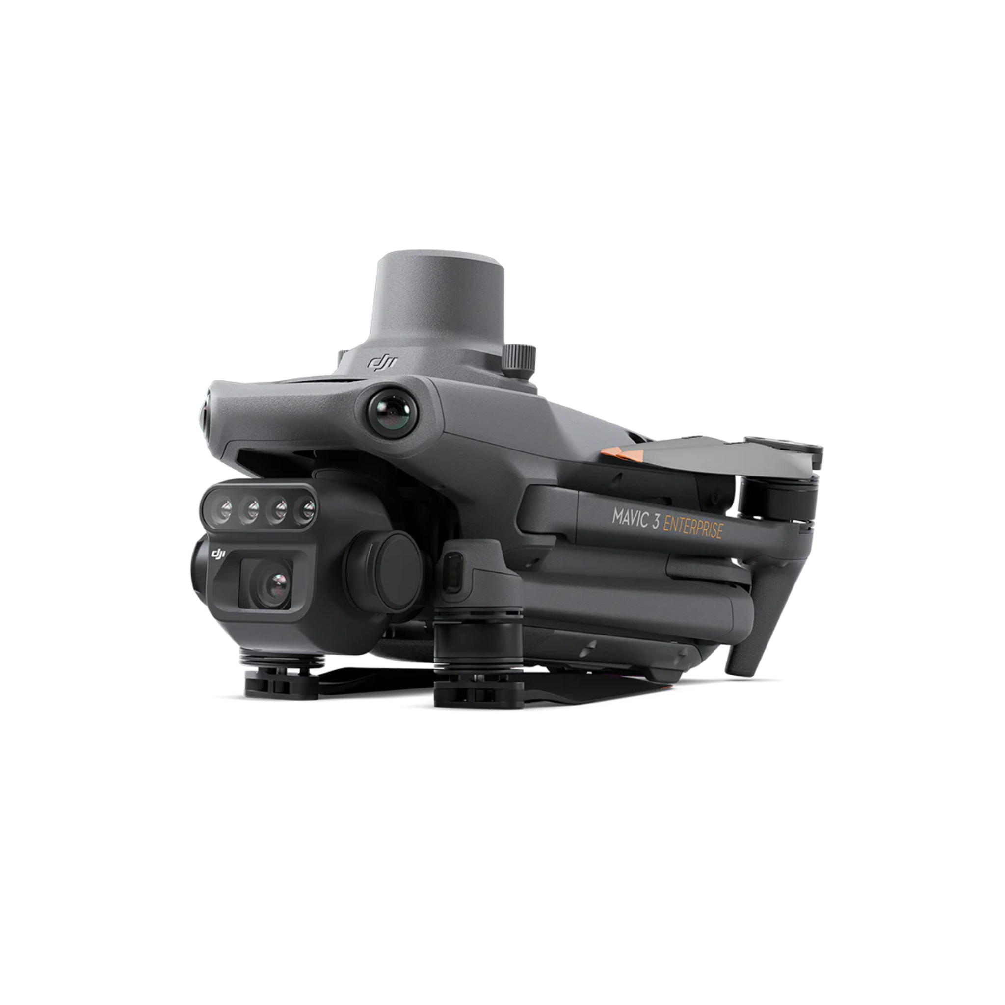
Designed for teams that need to move fast, the Mavic 3 Enterprise is lightweight, foldable, and easy to transport - making it ideal for rapid deployment in the field. Whether you're responding to an emergency, heading to a job site, or covering multiple locations in a single day, the compact form factor allows you to carry, set up, and launch in minutes.


Reliable Transmission in Any Environment
The Mavic 3 Enterprise features next-generation O3 Enterprise Transmission with a multi-antenna system designed to deliver stable, long-range connectivity in complex environments. With four built-in antennas and optimized signal performance between the aircraft and controller, operators benefit from a strong, low-latency video feed, while support for the DJI Cellular Dongle enables 4G Enhanced Transmission as a backup - helping maintain reliable control, clearer video, and safer flights even in areas with interference or signal obstruction.


Real-Time Terrain Follow
The Mavic 3E features Real-Time Terrain Follow, automatically adjusting altitude as it flies over areas with changing elevation to maintain consistent ground sampling and data accuracy. Powered by omnidirectional sensing, this capability eliminates the need for external elevation data, streamlining mapping workflows and enabling more efficient, reliable surveying in complex terrain.
Tech Specs
Flight & Performance
- Max Flight Time: Up to 45 minutes
- Max Speed: 19 m/s (~42 mph)
- Max Transmission Range: Up to 15 km (O3 Enterprise, FCC)
- Wind Resistance: Up to 12 m/s
- Max Takeoff Altitude: 6000 m
- Operating Temperature: -10°C to 40°C
Payload & Integration
Mavic 3E (Mapping):
- 20MP 4/3 CMOS sensor
- Mechanical shutter for distortion-free mapping
- Adjustable aperture (f/2.8–f/11)
Mavic 3T (Thermal):
- 48MP wide camera
- 12MP telephoto (56× hybrid zoom)
- 640×512 thermal sensor
- Temperature measurement up to 500°C
Sensing & Navigation
- Omnidirectional obstacle sensing (wide-FOV vision sensors)
- APAS 5.0 obstacle avoidance
- GNSS: GPS + Galileo + BeiDou + GLONASS
- RTK Support: Optional module for centimeter-level accuracy
- Real-Time Terrain Follow for mapping workflows
Battery & Power
- Battery Capacity: 5000 mAh (LiPo 4S)
- Flight Battery Energy: 77 Wh
- Charging Time:
~1 hr 10 min (charging hub)
~1 hr 20 min (direct aircraft) - Charging Power:
100W (hub)
65W (aircraft)
Included in the Box
Mavic 3T advanced x 1
Battery x1
Mavic 3T Protector Case x1
RC Pro Enterprise x1
USB-C 100W Power Adapter x1
100W Power Adapter Cable x1
USB-C Cable x1
Gimbal Protector x1
Screwdriver x1
Set of Propellers x2
SD Card x1
Everything you need to know
Get a complete breakdown of the Matrice 400’s capabilities, payload options, and real-world applications - so you can confidently choose the right setup for your mission.


JZ U3 Spotlight and Speaker Combo


NOTE - NO BATTERIES INCLUDED MUST PURCHASE SEPARATELY
Build Your bundle
Matrice 400 First Use Guide
From unboxing to first flight, this walkthrough shows you how to set up and operate the Matrice 400 with confidence - so you can get to work faster.
Compare the Mavic 3T
How the Mavic 3T's light weight and flight time compare with the step-up DJI Enterprise thermal platforms.


Flight Time
~45 minutes
Flight Time
~42 minutes
Flight Time
~41 minutes
Max Speed
21 m/s
Max Speed
21 m/s (S mode)
Max Speed
23 m/s
Wind Resistance
12 m/s
Wind Resistance
12 m/s (Level 6)
Wind Resistance
15 m/s (Level 7)
IP Rating
Not rated
IP Rating
IP54
IP Rating
IP55
Thermal Sensor
640×512 radiometric
Thermal Sensor
Uncooled VOx 640×512, radiometric
Thermal Sensor
640×512 radiometric
Laser Rangefinder
None
Laser Rangefinder
Up to 1,800m
Laser Rangefinder
Up to 1,200m
Video Transmission
O3+ (up to 15 km)
Video Transmission
O4 Enterprise (up to 20 km)
Video Transmission
O3 Enterprise (up to 15 km)
Takeoff Weight
~920 g
Takeoff Weight
~1,219 g
Takeoff Weight
~4.00 kg
FAQs
What is the difference between the Mavic 3E and Mavic 3T?
The Mavic 3E is designed for mapping and surveying, featuring a 20MP 4/3 CMOS sensor with a mechanical shutter for distortion-free aerial imaging and RTK support for centimeter-level accuracy.
The Mavic 3T is built for public safety and inspection, adding a 640×512 thermal camera along with a 48MP wide camera and up to 56× hybrid zoom for detecting heat signatures and capturing detailed visuals in real time.
What industries is the Mavic 3 Enterprise best suited for?
The Mavic 3 Enterprise Series is widely used in:
- Public safety (fire, police, search & rescue)
- Construction and surveying
- Utility and infrastructure inspection
- Energy and solar inspections
- Environmental and wildlife monitoring
How long can the Mavic 3 Enterprise fly?
The Mavic 3 Enterprise Series offers up to 45 minutes of flight time, allowing operators to cover large areas in fewer flights and improve overall mission efficiency.
Can the Matrice 400 carry multiple payloads at once?
Yes. The platform is designed for multi-payload configurations (up to 4), allowing operators to combine sensors like thermal, LiDAR, and communication systems in a single flight.
Is the Matrice 400 weather resistant?
Yes. With an IP55 rating, the Matrice 400 is built to operate in rain, dust, and challenging environmental conditions.
Does the Mavic 3 Enterprise support RTK for mapping?
Yes. The optional RTK module enables centimeter-level positioning accuracy, making the Mavic 3E ideal for precision mapping and surveying workflows without the need for ground control points.
How far can the Mavic 3 Enterprise fly?
Using DJI’s O3 Enterprise transmission system, the drone can achieve up to 15 km (FCC) transmission range in unobstructed environments, providing a stable, low-latency video feed.
Does the Mavic 3 Enterprise have obstacle avoidance?
Yes. It features omnidirectional obstacle sensing, helping operators safely navigate complex environments such as urban areas, structures, and industrial sites.
What can the thermal camera on the Mavic 3T detect?
The Mavic 3T’s thermal camera can detect heat signatures from people, animals, and equipment. It supports temperature measurement up to 500°C, making it ideal for firefighting, search and rescue, and industrial inspections.
Can the Mavic 3 Enterprise zoom in on distant objects?
Yes. The telephoto camera supports up to 56× hybrid zoom, allowing operators to inspect structures and objects from a safe distance without needing to fly close.
What software does the Mavic 3 Enterprise work with?
The platform integrates with DJI’s enterprise ecosystem, including:
- DJI Pilot 2 (flight control and mission planning)
- DJI Terra (mapping and reconstruction)
- DJI FlightHub 2 (fleet and mission management)
How quickly can the drone be deployed?
Thanks to its compact, foldable design, the Mavic 3 Enterprise can be deployed in minutes, making it ideal for rapid response scenarios.
Do I need training to operate the Mavic 3 Enterprise?
While the drone is user-friendly, operators should have proper training and follow local regulations, especially for commercial or public safety use.