Drones are rapidly becoming an essential tool in modern agriculture. With their ability to collect high-resolution data and execute tasks precisely, drones for agriculture empower farmers to monitor crops, manage inputs, and make data-driven decisions that directly increase yield. This article explores the five most impactful ways drones are transforming crop productivity today.
Introduction to Agricultural Drones
Agricultural drones, also known as unmanned aerial vehicles (UAVs), are transforming the agriculture industry by bringing advanced drone technology directly to the field. By integrating drone technology with precision agriculture, farmers can now collect reliable crop data and monitor crop health with unprecedented accuracy and efficiency. These drones enable comprehensive crop monitoring, allowing for detection of issues and more informed decision-making throughout the growing season. As a result, farmers are able to optimize their farming practices, increase crop yields, and reduce operational costs. The adoption of drones in agriculture is accelerating rapidly, with the global agricultural drone market expected to reach $4.8 billion by 2024. As drone technology continues to evolve, agricultural drones are becoming an indispensable tool for modern farmers, helping them stay competitive and sustainable in a fast-changing industry.
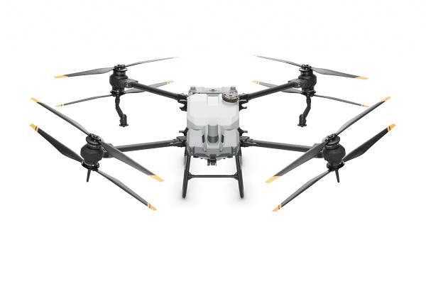
Components of an Agricultural Drone
An agricultural drone is a sophisticated piece of technology made up of several essential components, each playing a critical role in its operation and effectiveness. The frame forms the sturdy backbone of the drone, supporting all other parts and ensuring durability during aerial operations. Motors and propellers work together to generate the lift and thrust needed for flight, while the electronic speed control (ESC) system manages the speed and direction of each motor for stable maneuvering. The flight control board acts as the drone’s brain, processing data from various advanced sensors and executing commands for precise navigation.
A radio receiver allows the drone to receive instructions from the operator, ensuring responsive and safe drone operation. The battery powers all onboard systems, providing the energy needed for extended flight times. To capture high-quality imagery and data, a gimbal stabilizes the drone’s cameras and sensors, delivering smooth, high resolution footage even in challenging conditions.
Modern agricultural drones are equipped with a range of advanced sensors, including high resolution RGB cameras, multispectral cameras, and thermal cameras. These various sensors enable precise data collection on crop health, plant growth, and environmental conditions. With the integration of artificial intelligence and machine learning, agricultural drones can now analyze detailed data in real time, allowing farmers to make data-driven decisions that directly impact crop yields. By leveraging these advanced components, drones empower farmers to monitor crops more effectively, optimize natural resource allocation, and achieve better results season after season.
1. Crop Monitoring Drones for Early Problem Detection
High-Resolution Scouting from Above
Drones equipped with RGB and multispectral cameras can scan vast fields in minutes, capturing high resolution imagery and high resolution images for precise crop assessment, and identifying signs of plant stress, pest infestations, and nutrient deficiencies early. Compared to walking fields, drone scouting offers more frequent and consistent coverage. NDVI and thermal imagery enable farmers to spot problem areas days or even weeks before symptoms appear to the naked eye.
Unlike satellite imagery, which can be limited by lower resolution, higher costs, and cloud cover, drone-based imaging provides more detailed, timely, and accurate data for effective crop monitoring.
Catching Pests & Diseases Before They Spread
Real farmers report strong correlation between mid-season drone imagery and harvest-time yield maps. For example, one farmer used weekly drone flights to detect drought stress and pest patches, intervening early and saving his field from major losses. By using aerial crop monitoring, growers ensure no zone is overlooked, and they can act before minor issues become yield-threatening problems. Drones enable continuous monitoring of fields, allowing for timely pest control and disease management to further protect crop health and optimize yields.
2. Precision Crop Spraying with Drones
Targeted Pesticide & Fertilizer Application
Drone sprayers deliver treatments with centimeter-level accuracy. Unlike traditional rigs, which often over-apply or compact soil, drones can apply inputs exactly where needed without disturbing the ground. This reduces input waste and maximizes coverage efficiency. Precision mapping and efficient data collection from drones further support targeted and efficient input use, ensuring that resources are applied only where and when they are needed most.
Case Study – Cutting Costs and Raising Yields
Parker Farms in Iowa documented an 8% yield increase and 28% reduction in herbicide use after switching to drones for herbicide applications. These improvements also led to significant cost savings by reducing operational expenses and resource use. In another case, a farmer saved thousands by treating only a 25-acre disease patch identified via drone, rather than blanket-spraying all 400 acres. The targeted treatment was made possible by the resulting data from drone flights, which enabled precise intervention.
3. Improved Irrigation Management
Thermal Imaging for Water Stress
Thermal and multispectral drone sensors, utilizing remote sensing technologies, reveal irrigation patterns and soil moisture variations, helping farmers spot over-watered or dry areas. Early detection prevents drought stress or root rot, both major causes of yield loss.
Water Savings and Yield Stability
In California, one orchard cut water use by 40% using drone-guided irrigation without sacrificing yields. This drone technology also improves farming efficiency by optimizing water distribution and reducing resource waste. Drone maps also help detect broken drip lines or inefficient sprinklers. Proper moisture management, informed by drones, keeps crops consistently healthy.
4. Drone Seeding and Planting
Faster Cover Crop Seeding
Seeding drones can sow 20–30 acres per hour with even distribution. They’re ideal for cover crops or replanting thin areas, especially in wet or rugged terrain where tractors struggle. Drones equipped with vertical takeoff capability and hybrid gasoline power offer significant advantages in these challenging environments, providing adaptability, longer flight times, and the ability to operate without the need for runways.
Uniform Plant Stands for Higher Yields
Unlike mechanical planters that may skip or double-plant, drones deliver seeds uniformly with no soil compaction. This results in even emergence, healthier stands, and ultimately, better yields. Drones also enable precise monitoring of crop growth, allowing for assessment of plant development and timely interventions to optimize yields. Trials show yield boosts comparable to traditional methods, particularly in tricky field conditions.
5. Data-Driven Precision Farming Decisions
Mapping & Analytics
Every drone flight produces a wealth of data – from crop vigor indices to 3D terrain maps. In precision agriculture applications, advanced multispectral imaging enables the use of the normalized difference vegetation index (NDVI) to monitor crop health and detect issues such as disease, pests, and plant stress. Farmers use this to create prescription plans for variable-rate fertilization, planting, or irrigation, tailoring inputs to each field zone.
Predicting Yields and Optimizing Inputs
Drone-guided precision farming has led to documented yield increases (e.g., 10 bushels per acre in corn) while reducing input costs by 15-20%. One farmer saw a $35/acre profit increase after using drone insights to adjust nitrogen application. Drones also support better crop management decisions by providing real-time data for early disease detection, precise resource application, and yield optimization.
Getting Started: Step-by-Step Drone Farming Guide
Thinking about integrating drones into your farm operations? Follow this in-depth guide to make the process seamless and effective. Staying updated with current drone technology and recent drone technology advances is crucial for effective adoption and maximizing the benefits of drones in agriculture.
Step 1: Evaluate Your Farm's Needs
Identify where drones could add the most value to your operation:
-
Crop Monitoring: Scouting for pests, diseases, or nutrient deficiencies.
-
Spraying: Targeted application of pesticides or fertilizers.
-
Irrigation Management: Thermal scans to find dry or over-watered spots.
-
Seeding: Broadcasting cover crops or replanting thin areas.
-
Data Collection: Creating prescription maps, plant counts, or 3D models.
Consulting with agricultural professionals can help you identify the most impactful drone applications for your specific farm needs.
Step 2: Choose the Right Drone Model
Select a drone based on your primary goals:
-
Multispectral Drones: Ideal for crop health analysis.
-
Sprayer Drones: Built for applying inputs precisely.
-
Thermal Drones: Useful for irrigation diagnostics.
-
Mapping Drones: Perfect for terrain and prescription mapping. Consider payload capacity, battery life, camera specs, and software compatibility.
Step 3: Get Licensed (U.S. FAA Part 107)
If you're flying commercially in the U.S., you'll need to:
-
Pass the FAA Part 107 Aeronautical Knowledge Test.
-
Register your drone with the FAA.
-
Follow local and federal airspace rules.
-
Optional: Get certified for aerial pesticide application (varies by state).
Step 4: Plan and Execute Your First Flight
Start small and safe:
-
Pick a clear, calm day.
-
Begin with basic scouting missions.
-
Use pre-programmed flight paths where possible.
-
Ensure batteries are charged and firmware is updated.
-
Log your flight data and observations.
Step 5: Analyze and Integrate the Data
Convert flight data into insights:
-
Use NDVI or thermal maps to guide treatment.
-
Export geotagged images into mapping software.
-
Create variable-rate application plans.
-
Compare data to yield maps for long-term ROI evaluation.
Step 6: Scale Up Gradually
Once confident, expand drone usage:
-
Increase flight frequency during growing seasons.
-
Add capabilities like spraying or seeding.
-
Collaborate with agronomists or drone service providers.
-
Continue training and stay current on regulations.
By following these steps, farmers can reduce input costs, increase yields, and make their operations more efficient and sustainable. Drones are no longer just a high-tech gadget – they are a key part of the future of farming.
FAQ – Drones in Agriculture
How do drones help farmers increase crop yield?
Drones help increase crop yield by enabling early detection of issues, guiding targeted input applications, improving irrigation management, and supporting data-driven decision-making. These actions minimize waste and maximize productivity in every zone of a field.
What are the main uses of drones in agriculture today?
The primary applications of agricultural drones include crop health monitoring, precision spraying, thermal irrigation analysis, drone seeding/planting, and data collection for precision farming decisions. These tools streamline operations and optimize crop performance.
How can drones be used for crop monitoring and early disease detection?
Drones equipped with RGB and multispectral cameras capture aerial images that reveal stress patterns, pest outbreaks, and disease symptoms before they are visible to the eye. Farmers can act promptly to stop the spread and minimize yield loss.
Can drones effectively spray crops with pesticides or fertilizers?
Yes. Sprayer drones deliver chemicals with pinpoint accuracy, reducing over-application, input costs, and environmental runoff. Studies show they can reduce chemical use by up to 30% while improving yield and avoiding soil compaction.
What are the benefits of drones for precision farming and input management?
Drones provide site-specific data that allows for precision application of inputs like seed, fertilizer, and pesticides. This reduces waste, improves ROI, and helps ensure that each part of the field receives exactly what it needs to thrive.
How do drones improve irrigation and water management on farms?
Thermal and multispectral imaging from drones reveals moisture variability across fields. Farmers use this data to fix irrigation issues, adjust schedules, and apply water more efficiently, reducing water use while maintaining or improving yields.
Can drones be used for planting or seeding, and does it impact yield?
Yes. Seeding drones are being used to plant cover crops and re-seed thin areas, especially in challenging terrain. These drones ensure even distribution and avoid soil compaction, which promotes uniform emergence and stronger yield performance.
Do agricultural drones really pay off for farmers (ROI and cost-effectiveness)?
Absolutely. Many farmers report ROI within one to two seasons. Yield increases (5-11%) and input savings (15-30%) often outweigh the initial drone cost. Custom spraying and scouting services also reduce the barrier to entry for small scale farms.
How much can drones increase crop yields in real-world cases?
Field trials and case studies show drones can boost yields by 5-11%, with some farmers reporting even higher gains when combining drones with other precision ag practices. For example, Parker Farms achieved an 8% bump from drone-guided spraying.
What challenges or limitations do farmers face when using drones?
Challenges include initial investment costs, required training/licensing (Part 107 in the U.S.), weather limitations, and learning curve with software and analytics. However, falling prices, easier platforms, and ROI tools help mitigate these concerns.
Are drones in agriculture sustainable and environmentally friendly?
Yes. Drones reduce chemical overuse, minimize soil compaction, and cut water waste, supporting sustainable practices. They also enable precision that reduces emissions from excess fuel and equipment usage.
What training or regulations are required for farmers to use drones safely?
In the U.S., any commercial drone use requires FAA Part 107 certification. Training is widely available and typically includes airspace rules, weather, safety, and flight skills. Additional training may be needed for pesticide application depending on state laws.
Conclusion – The Sky-High Future of Farming
Agricultural drones are helping farmers grow more with less by enabling smarter, faster, and more efficient decisions. From catching diseases early to optimizing water use and planting evenly, drones are proving to be powerful allies in the mission to feed a growing world. Interested in bringing drone technology to your farm? Contact our team at Global Drone HQ to learn how we can help you get started.
Share:
Drones For Construction Industry: How They Are Transforming the Sector
How to Train Your Team to Operate Enterprise Drones Safely