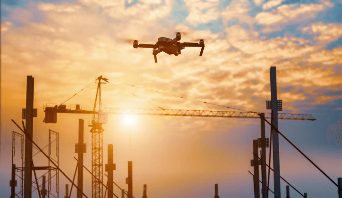
In the U.S. construction industry, drones have evolved from tech novelties into powerful tools for planning, monitoring, and safety within the construction space, where operational efficiency and data-driven decision-making are critical. Drone adoption is rapidly becoming a key trend in the construction space, transforming how projects are managed and executed. With drone mapping and inspections, teams can survey large areas in hours rather than days, monitor progress in real time, and perform hazardous inspections with no risk to personnel¹. Studies show drone-based site surveys can be up to 5× faster and survey costs may drop by around 20%². In fact, 84% of construction and project managers report drones deliver shorter timelines, fewer errors, and more accurate tracking³. As FAA Part 107 licensing and drone analytics mature, more firms are using drones to work faster, safer, and smarter. Additionally, drones streamline construction workflows and processes by automating data manual collection, improving inventory control, and simplifying project management.
Introduction to Drones in Construction
The construction industry is experiencing a revolution as drones become an integral part of construction projects across the globe. Drones in construction are transforming the way construction companies approach site assessments, project planning, and progress monitoring. By leveraging advanced drone technology, construction teams can capture high resolution images and gather precise data in real time, allowing for more accurate decision-making and streamlined workflows. The ability to monitor construction progress from above not only expedites project timelines but also enhances overall site security and reduces labor costs. As the construction drone market is projected to reach $11.96 billion by 2027, it’s clear that drones are no longer a luxury but a necessity for modern construction sites. With improved site security, better data, and faster project delivery, drones are setting new standards for efficiency and safety in the construction industry.
What Are Drones Used for on Construction Sites?
Surveying & Mapping
Drones equipped with RGB or LiDAR sensors are widely used for site surveying, enabling rapid and efficient data collection across large construction sites. These drones can produce high-precision topographic maps and 3D models, with topographic mapping being a key output for construction site planning and earthwork estimation. By capturing high resolution aerial images and aerial images, drones provide detailed visual data for analysis and infrastructure planning. The use of a mechanical shutter ensures fast, reliable, and high-quality image capture, which is essential for mapping and surveying tasks. 3D modeling from these images allows for detailed visualizations of construction sites, helping identify design challenges and providing clients with a preview of the final outcome. Advanced GPS and mapping features in drones support accurate data collection, which is critical for effective construction management. Achieving 1–3 cm accuracy, drones enable precise mapping, improving productivity, reducing material waste, and ensuring accurate surveying and monitoring. This level of detail can be accomplished in hours—compared to days for traditional crews⁴—enabling more efficient earthwork planning and volumetric analysis⁵.
Progress Monitoring and Reporting
Weekly aerial flights allow project teams to overlay current conditions over BIM or schedule data, enabling accurate monitoring construction progress and workflow tracking. Drone data supports progress tracking by integrating with construction management systems for comprehensive project analysis. Drones also enable continuous progress monitoring and job site monitoring, providing ongoing oversight of construction sites to improve accuracy and efficiency. This promotes transparency with stakeholders and reduces rework disputes⁶, while giving project teams access to real time data for timely decision-making.
Safety Inspections and Security
Drones inspect façades, roofs, cranes, and other elevated structures, including hard to reach areas, without exposing workers to fall risks⁷. By accessing these hard-to-reach areas, drones can safely identify potential safety hazards on job sites. Thermal and zoom sensors reveal structural anomalies, insulation leaks, and electrical hotspots with no one having to climb scaffolding⁸, significantly reducing safety risks compared to traditional manual inspection methods.
Other Uses
Additional roles include marketing visuals, stockpile measurement for billing, infrastructure inspection, and promotional photography. Drones can capture aerial footage that enhances client engagement and marketing materials, providing unique perspectives for project updates and early problem detection. With a single flight, drones can document the entire job site, offering comprehensive visual records without disrupting operations. Drones also offer real-time site communication—boosting team collaboration by up to 65%⁹ and supporting the construction project as a whole.
Equipment Tracking
Managing equipment across sprawling construction sites can be a logistical challenge, but drones are making it easier than ever. By deploying drones equipped with high resolution cameras and advanced sensors, construction teams gain a comprehensive aerial perspective of all assets on job sites. This real-time visibility allows project managers to track the exact location and utilization of machinery, vehicles, and tools, helping to optimize asset management and minimize equipment downtime. Regular aerial surveys conducted by drones can quickly identify misplaced or underutilized equipment, reducing the risk of theft and ensuring resources are always where they’re needed most. With drone technology, construction sites can operate more efficiently, cut unnecessary costs, and improve overall construction management.
Stockpile Measurement
Accurate stockpile measurement is essential for effective resource allocation and construction planning. Drone data has revolutionized this process by enabling precise volumetric calculations of materials like aggregates, sand, and soil. Using photogrammetry techniques, construction drones can capture detailed aerial imagery and generate 3D models of stockpiles, eliminating the need for time-consuming manual surveys and reducing the risk of measurement errors. Construction companies and teams can now monitor inventory levels in real time, optimize material usage, and minimize waste. By integrating drone technology into stockpile management, construction projects benefit from improved accuracy, better resource allocation, and more efficient planning throughout the construction process.
Environmental Monitoring
Sustainable construction practices are more important than ever, and drones are playing a key role in helping construction companies meet environmental regulations. Environmental monitoring drones, equipped with specialized sensors, can track air and water quality, monitor vegetation health, and observe wildlife activity on and around construction sites. This comprehensive data collection allows construction professionals to identify and address potential environmental impacts early in the project lifecycle, ensuring compliance with environmental regulations and minimizing ecological disruption. By using drones for environmental monitoring, construction projects can maintain steady site progress while reducing their environmental footprint and supporting long-term sustainability goals.
Quality Control
Ensuring high construction quality is critical to the success of any project, and drones are elevating quality control standards across the industry. High-resolution drone imagery provides construction teams with detailed visual data, enabling thorough inspections of structural components and finishes throughout the construction process. Drones help identify defects, deviations from plans, or potential hazards early, allowing for prompt corrective action and reducing the risk of costly project delays. By integrating drone-based quality control with modern construction practices like Building Information Modeling (BIM), construction professionals can monitor construction progress more effectively, ensure compliance with safety regulations, and deliver higher-quality results to clients. Regular drone inspections not only enhance project outcomes but also support a culture of safety and continuous improvement on every job site.
Benefits of Using Drones in Construction
Efficiency and Speed Gains
Construction drone workflows are significantly faster—surveys take hours, not days, and site inspections that once required full crews are reduced to minutes¹⁰.
Cost Savings and ROI
Case studies show inspection time cut by 50–60% (compared to manual inspections), labor savings around 20–30%, and project ROI improvements of 15–25%¹¹. Drone deployment helps minimize rework through early detection of issues.
Improved Safety for Workers
By replacing dangerous visual inspections with drone overflights, construction companies reduce exposure to falls and hazardous zones—helping raise safety standards by up to 55%¹².
Data Accuracy & Decision‑Making
Drone data—especially from RTK-enabled sensor platforms—offers precision unmatched by manual methods. Stockpile volumes, plan conformity, and earthwork metrics benefit from centimeter-grade accuracy⁴.
How to Implement Drones in Construction
Getting Licensed (FAA Part 107 and Training Pilots)
U.S.-based operators must obtain a Part 107 Remote Pilot Certificate and register each UAS with the FAA⁵. Drone Pilots must renew every two years; study materials like the official ACS guide and FAA practice questions are available online⁷.
Choosing the Right Drone & Software
Selection depends on payload needs (LiDAR, thermal, RGB). RTK-capable platforms such as DJI Enterprise models paired with mapping platforms (e.g., DroneDeploy, Pix4D) are ideal for high-accuracy workflows.
Integrating Data into BIM/Workflows
Drone imagery and point clouds can be imported into BIM or virtual construction platforms to cross‑check as-built against design, manage quality, or power virtual walkthroughs.
Tips for Starting Small and Scaling Up
Begin with weekly drone surveys of a small plot. Build a repeatable flight plan, process aerial imagery, and develop a reporting cadence before scaling across sites.
Challenges and Considerations
Regulations & Compliance:Navigating airspace is critical—Part 107 pilots often need waivers for flights over people or at night. Remote ID and registration (each drone must be marked and broadcast ID) are mandatory¹³. Government agencies are also key users of construction drones and must comply with specific regulatory requirements, especially for large-scale infrastructure and public sector applications.
Operational Limitations: Typical flight times range from 20–40 minutes per battery—which may require multiple flights for larger sites. Weather, terrain, and obstacle density may limit coverage. Battery life is a key consideration depending on your projects needs.
Integration & Training Barriers: Analysis of drone data requires technical skill; adoption may require hiring a GIS specialist or training engineers. A licensed surveyor may still need to validate official deliverables.
Cost and ROI Pressure: Upfront costs include drone hardware, construction management software licensing, training, and insurance. ROI builds over multiple projects,—which may deter smaller contractors without clear long-term value¹⁴.
The Future of Construction Drones
-
Autonomous drone-in-a-box systems are rolling out to perform scheduled flights without human drone pilots—ideal for routine progress monitoring¹⁵.
-
AI-powered analytics now flag site anomalies such as missing PPE, structural shifts, or schedule delays in real time¹⁶.
-
Deeper BIM integration and live digital twin updates are creating responsive environments for project teams.
-
Emerging drone applications—such as environmental sensors, swarm inspection, and even additive manufacturing—are pushing the technology into Construction 4.0⁷.
FAQ: Common Questions about Construction Drones
Do I need a license to fly a drone on a construction site?
Yes. In the U.S., you must obtain an FAA Part 107 Remote Pilot Certificate for any commercial drone operations⁵.
How much does a construction drone program cost?
Expect hardware and software setup plus training to cost several thousand dollars initially—though many firms realize 15–25% ROI across multiple projects¹¹.
Can construction drones replace surveyors or site inspectors?
No. While drones are great for aerial data collection, licensed professionals are still needed to certify maps and inspect material conditions in person⁸.
What about privacy when using construction drones on site?
Operators must be mindful of local and federal privacy laws and airspace restrictions. Urban areas like NYC still require special permits for drone operations.
Are drone workflows scalable?
Absolutely—modern companies are implementing scheduled flights, cloud processing, and BIM integration to scale drone use across multiple projects efficiently.
Implementing drones into your construction workflow doesn’t need to be complex. Here’s a straightforward step-by-step process to get started:
How to Launch a Drone Program on Your Construction Site
Step 1: Get Certified to Operate Commercial Drones
To fly drones commercially in the U.S., your pilot or team must hold a Part 107 Remote Pilot Certificate from the FAA. This ensures legal compliance and safety knowledge.
Step 2: Identify Use Cases & Internal Needs
Define where drones will provide the most ROI—surveying, inspections, progress tracking, or all of the above. Talk to your field teams and project managers for input.
Step 3: Choose the Right Drone & Payload
Select an enterprise-grade drone with the right payload. For construction, top options include the DJI Matrice 350 with a Zenmuse H30T, or the Autel EVO Max 4T for thermal and zoom capabilities.
Step 4: Run a Pilot Test
Start with one job site. Establish workflows for flight planning, data collection, and integration with existing project management tools like Procore or Bluebeam.
Step 5: Create SOPs & Train Staff
Standardize operations with written procedures. Train your in-house pilots or contract with licensed operators to ensure safety and efficiency.
Step 6: Scale Across Sites
Once your workflow is dialed in, deploy drone teams to additional sites. Continue tracking KPIs like survey time, data accuracy, and safety incidents.
Conclusion
Drones are rapidly shifting from a novelty to an essential tool in U.S. construction industry—enhancing efficiency, cutting costs, and boosting onsite safety and accuracy. To stand out in competitive bidding and deliver smarter projects, construction firms must consider adopting drone-enabled workflows. Starting with licensed drone pilots and targeted pilot programs, operators can build a scalable drone strategy that pays dividends over time.
Ready to take off? Contact us to explore drone services tailored to construction operations or check out our enterprise drone solutions today.
Share:
DJI H30T Review: The Only Guide You Need to Read
Top 5 Ways Farmers Use Drones to Improve Crop Yield