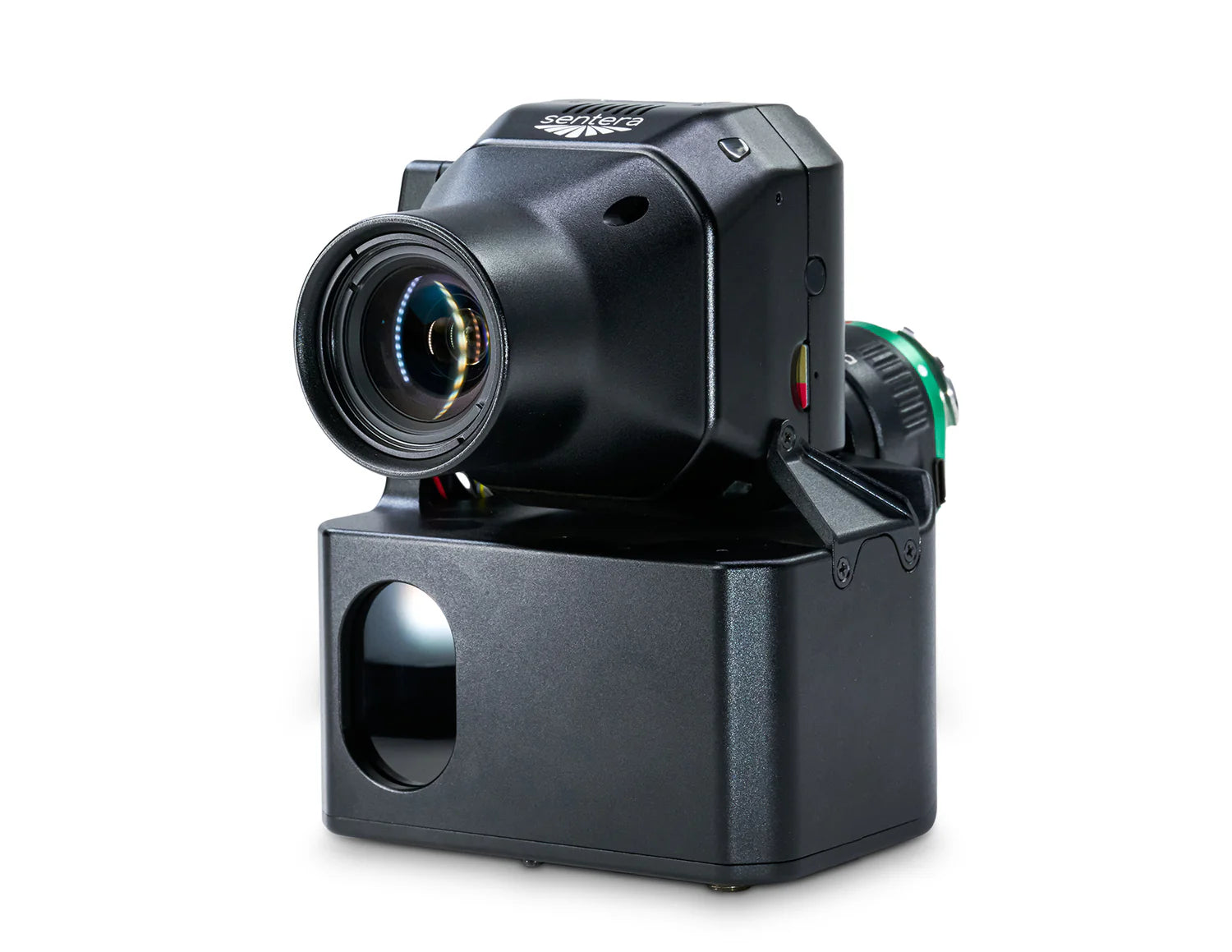
Sentera Direct Georeferencing System (DGR) with 65R Sensor for DJI M350
Enterprise pricing, payment terms and bulk orders — talk to a drone specialist.
How It Works
1. Quick Setup & Flight Preparation
Eliminate the need for ground control points by easily connecting the Sentera DGR System to the DJI M350 RTK. In just a few steps, add tactical-grade IMU and dual RTK GPS functionality for precise geolocation and streamlined mission planning.
2. Faster Data Capture
With 50% less image overlap required, the system captures 9x fewer images for analysis—reducing flight time from 45 minutes to under 20 minutes while maintaining high accuracy and efficiency.
3. Rapid Data Processing & Analysis
With 5x faster data delivery, spend less time waiting and more time analyzing critical agronomic insights for faster, more informed decision-making.
4. Efficient Post-Processing
The Sentera DGR System provides absolute location accuracy, generating spatially accurate maps directly at the field’s edge. This eliminates the need for time-consuming image stitching to create an orthomosaic.
Paired with Sentera 65R Sensor – Ultra-High-Resolution Aerial Imagery
The Sentera 65R is the first ultra-high-resolution precision sensor built from the ground up for seamless integration with RTK-enabled drone systems, delivering unmatched clarity and efficiency in aerial imaging.
More Pixels Per Image, Captured Faster
With a ground sampling distance of 0.45cm/pixel, the Sentera 65R captures significantly more detail per image—allowing for faster, more accurate data collection than any other camera on the market. This results in improved efficiency and reduced errors, enabling high-precision mapping at an unprecedented scale.
The Sentera DGR System and 65R Sensor work together to redefine precision agriculture, providing the fastest, most accurate geospatial data collection available today.
Enterprise pricing, payment terms and bulk orders — talk to a drone specialist.
Pairs well with
In stock! Ships within 1-2 business days.
Sentera Direct Georeferencing System (DGR) with 65R Sensor for DJI M350
If you have any questions, you are always welcome to contact us. We'll get back to you as soon as possible, within 24 hours on weekdays.
-
Shipping Information
We ship enterprise and commercial drone equipment across the United States. In-stock items typically ship within 1 to 2 business days. Certain enterprise, custom, and built-to-order items (such as portable rapid chargers) require additional lead time, which is confirmed at the time of order. You will receive tracking by email once your order ships. For expedited shipping, freight, or international inquiries, contact support@globaldronehq.com.
-
Customer Support
Our team helps you choose the right platform and get the most out of it. For product questions, order status, warranty claims, or technical support, reach us at support@globaldronehq.com or (858) 906-5185, Monday through Friday. As an authorized dealer for leading drone, sensor, and field-equipment brands, we help match the right solution to your mission, whether you fly for public safety, mapping, agriculture, inspection, or industrial operations.
-
FAQ’s
Are you an authorized dealer? Yes. We are an authorized dealer for the brands we carry, so your equipment includes full manufacturer warranty and support.
Do you offer quotes and purchase orders? Yes. We work with government, public safety, and commercial customers. Email support@globaldronehq.com with your requirements for a formal quote.
What payment methods do you accept? We accept major credit cards and, for approved business and agency orders, ACH or wire transfer.
How long will my order take? In-stock items ship in 1 to 2 business days. Built-to-order items have lead times confirmed at the time of order.
-
Contact Us
Global Drone HQ
Email:support@globaldronehq.com
Phone: (858) 906-5185
Hours: Monday through Friday
For sales quotes, purchase orders, and dealer or agency inquiries, email us and a specialist will respond promptly. We welcome RFQs from government, public safety, and commercial customers.