DJI Enterprise
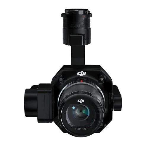
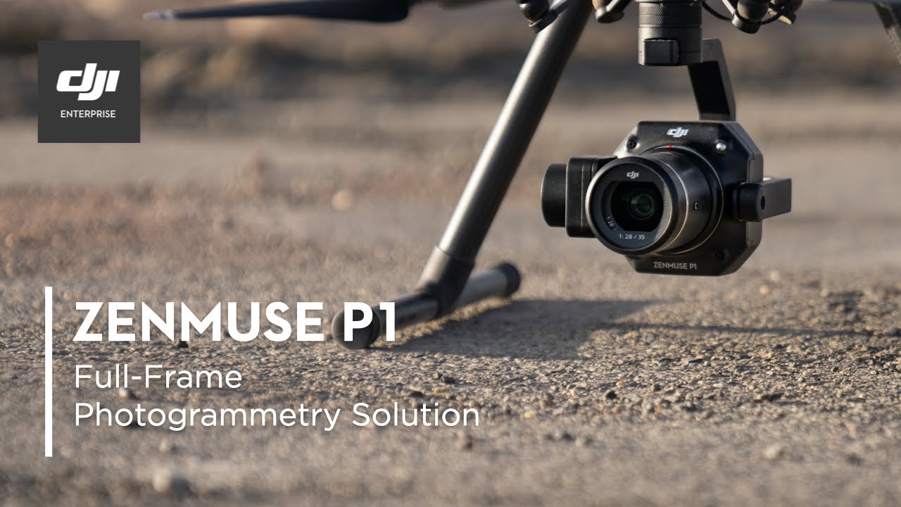
DJI Zenmuse P1 Full-Frame Photogrammetry Camera
Enterprise pricing, payment terms and bulk orders — talk to a drone specialist.
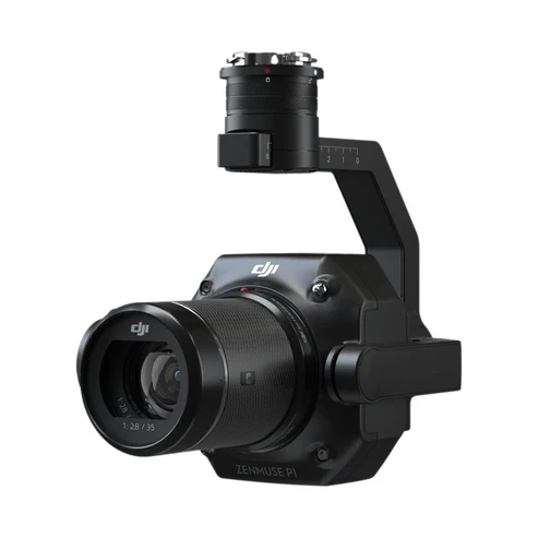
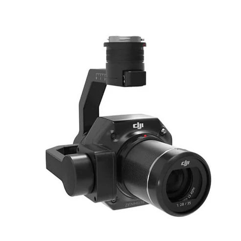
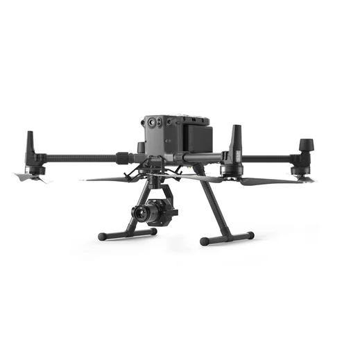
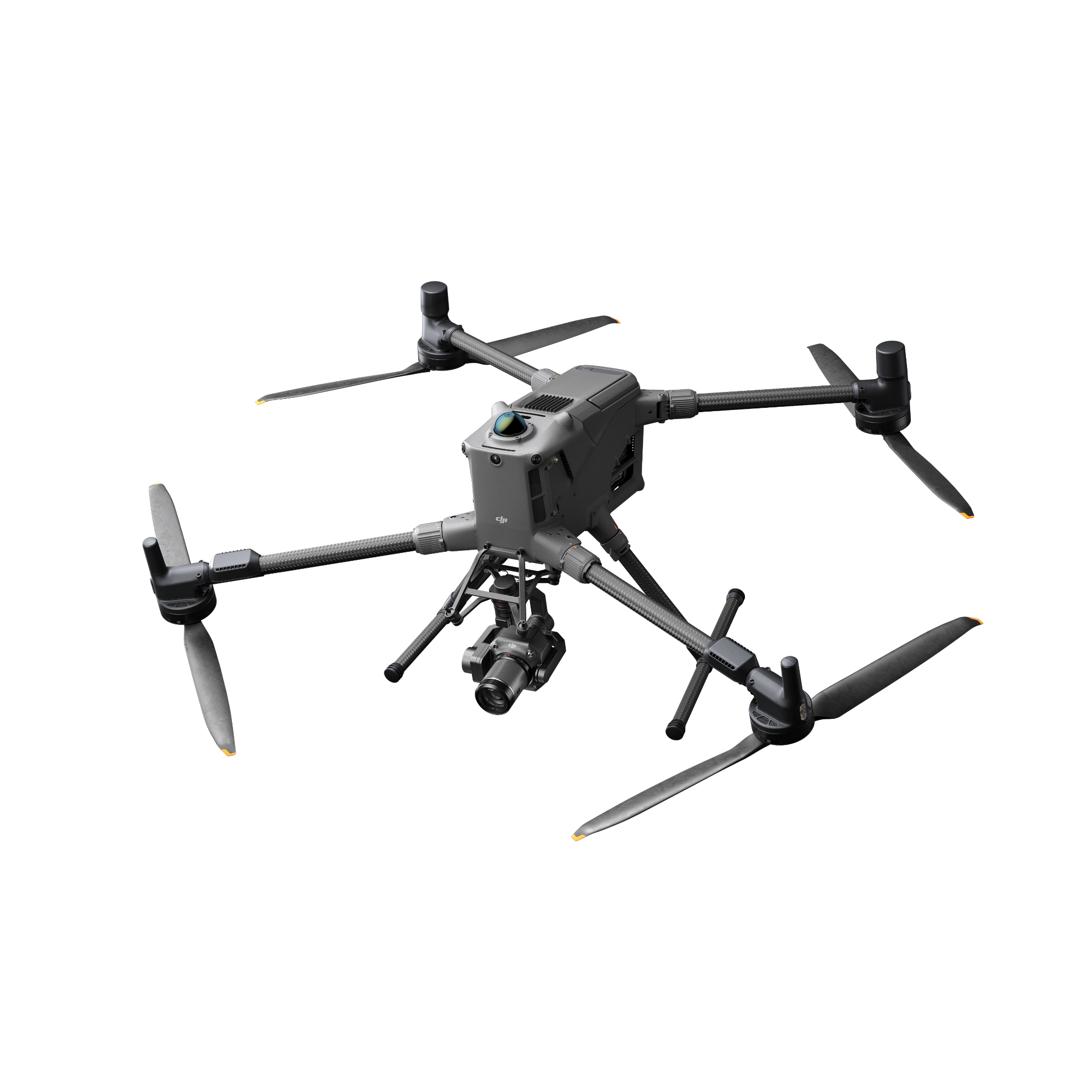
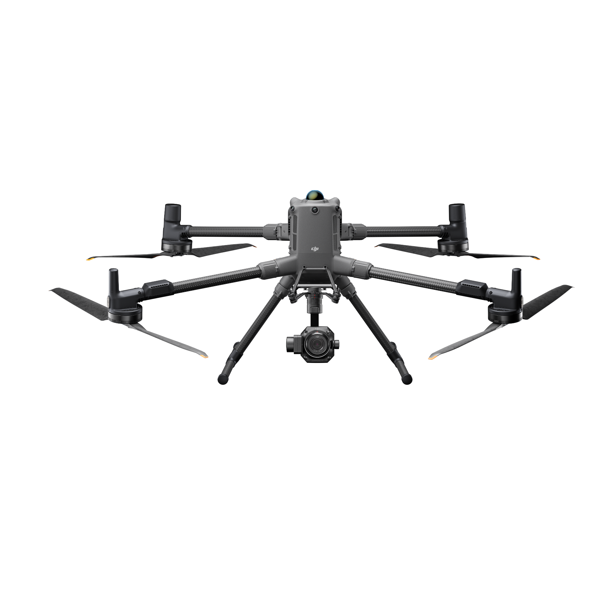
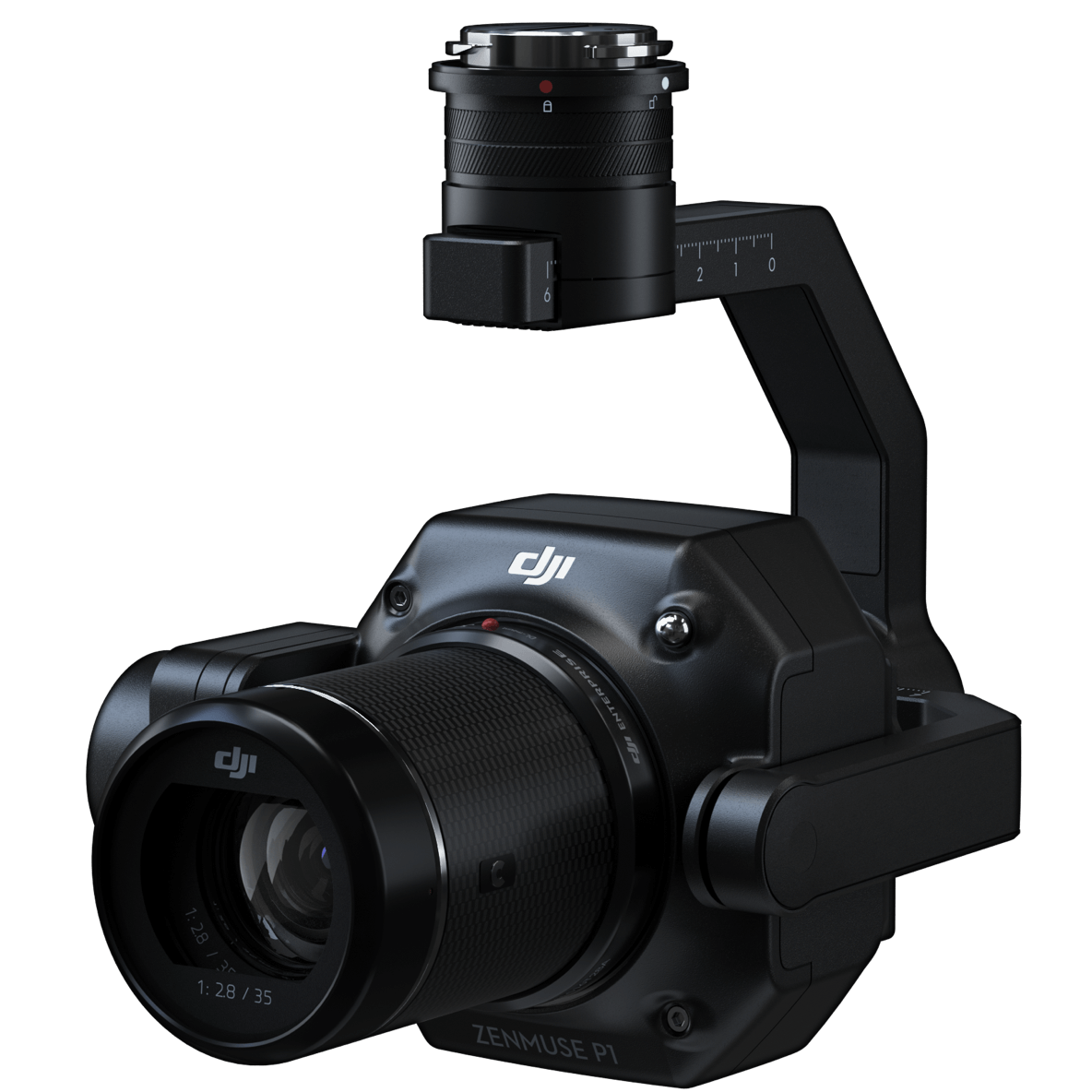
The DJI Zenmuse P1 is a professional full-frame photogrammetry payload built for high-accuracy aerial surveying on the Matrice 300 RTK, Matrice 350 RTK, and Matrice 400 RTK. It combines a 45MP full-frame CMOS sensor (35.9 x 24mm) with a 3-axis stabilized gimbal, a global mechanical shutter, and three interchangeable DL prime lenses (24mm, 35mm, and 50mm f/2.8) to capture distortion-free imagery across any terrain type or survey scale.
Built for survey teams that need to cover large areas efficiently, the P1 fires a new frame every 0.7 seconds and maps up to 3 km² in a single flight at 100m AGL with the 24mm lens. TimeSync 2.0 synchronizes each exposure to the RTK GNSS feed at microsecond precision, producing 3 cm horizontal and 5 cm vertical accuracy without deploying ground control points on every site. Smart Oblique Capture enables nadir and multi-angle imagery in one pass, generating complete 3D reconstructions far faster than traditional multi-flight workflows.
DJI Zenmuse P1 Specs
| Spec | Value |
|---|---|
| Sensor | 45MP full-frame CMOS, 35.9 x 24mm, 4.4μm pixel pitch |
| Resolution | 8192 x 5460 (45MP effective pixels) |
| Lenses | DL 24mm, 35mm, 50mm f/2.8 LS ASPH (interchangeable) |
| Min Photo Interval | 0.7 seconds |
| Coverage | Up to 3 km² per flight at 100m AGL (24mm lens) |
| Accuracy | Horizontal: 3cm / Vertical: 5cm (RTK-assisted, no GCPs) |
| Gimbal | 3-axis stabilized, ±0.01° angular vibration range |
| Shutter | Global mechanical (1/2000 to 1s), electronic (1/8000 to 1s) |
| Compatible Aircraft | DJI Matrice 300 RTK, Matrice 350 RTK, Matrice 400 RTK |
| Processing Software | DJI Terra (native), Pix4D, Agisoft Metashape |
| Weight | Approx. 800g |
| IP Rating | IP4X |
Use Cases
- Land Surveying — Centimeter-accurate orthomosaics and 3D models for boundary, topographic, and cadastral surveys
- Construction Monitoring — Progress documentation, earthwork volumes, and as-built verification at full-frame detail
- Mining and Quarry — Stockpile volume calculations and haul-road mapping with high-resolution photogrammetric models
- Corridor Mapping — Roads, railways, and pipeline routes captured efficiently with Smart Oblique Capture in a single pass
Related Resources
- DJI Matrice 400 RTK Payloads Guide — H30T, L3, P1, V1 and S1 compared
- Complete DJI Enterprise Drone Payloads Guide — full compatibility matrix across all platforms
- Zenmuse L3 LiDAR Camera — pair with the P1 for simultaneous LiDAR and photogrammetry on M400 RTK
- Zenmuse H30T — 5-sensor thermal payload for M400 RTK SAR and public safety operations
- DJI Matrice 400 RTK — compatible aircraft for the Zenmuse P1
Pairs well with
In stock! Ships within 1-2 business days.
Covered by DJI's manufacturer warranty — [View Warranty Details]
DJI Zenmuse P1 Full-Frame Photogrammetry Camera
If you have any questions, you are always welcome to contact us. We'll get back to you as soon as possible, within 24 hours on weekdays.
-
Shipping Information
Use this text to answer questions in as much detail as possible for your customers.
-
Customer Support
Use this text to answer questions in as much detail as possible for your customers.
-
FAQ’s
Use this text to answer questions in as much detail as possible for your customers.
-
Contact Us
Use this text to answer questions in as much detail as possible for your customers.
Full-Frame Photogrammetry, Built for Survey-Grade Precision
The DJI Zenmuse P1 combines a 45MP full-frame sensor, interchangeable DL lenses, and RTK precision to deliver centimeter-accurate orthomosaics and 3D models in a single flight. Designed for land surveyors, civil engineers, and mapping professionals, it captures more ground in less time without sacrificing accuracy.

Full-Frame Detail Across Any Survey
Capture distortion-free imagery across open terrain, urban corridors, and complex topography with the P1's 45MP full-frame CMOS sensor. Three interchangeable DL prime lenses (24mm, 35mm, and 50mm f/2.8) let you match field of view to mission requirements. A global mechanical shutter eliminates rolling shutter distortion for clean, reliable orthomosaics every time.

Centimeter Accuracy, Without the GCPs
With RTK positioning and TimeSync 2.0, the P1 synchronizes every exposure to the GNSS feed at microsecond precision, delivering 3 cm horizontal and 5 cm vertical accuracy without deploying ground control points across the site. Reduce setup time, field crew requirements, and post-processing overhead on every project.

More Ground Covered, Fewer Flights
The P1 captures a new frame every 0.7 seconds and covers up to 3 km² in a single flight at 100m AGL with the 24mm lens. Smart Oblique Capture collects nadir and multi-angle imagery in one pass, producing complete 3D reconstructions that would otherwise require multiple sorties. More data, faster turnaround, lower mission cost.
Tech Specs
Key Specifications
- Sensor: 45MP full-frame CMOS, 35.9 x 24mm, 4.4-micrometer pixel pitch
- Resolution: 8192 x 5460
- Lenses: DL 24mm, 35mm, 50mm f/2.8 LS ASPH (interchangeable)
- Min Photo Interval: 0.7 seconds
- Coverage: Up to 3 km² per flight at 100m AGL (24mm lens)
- Accuracy: Horizontal 3cm / Vertical 5cm (RTK-assisted, no GCPs required)
- Supported Aircraft: DJI Matrice 300 RTK / 350 RTK / 400 RTK
- Workflow Integration: DJI Terra (native), Pix4D, Agisoft Metashape
Imaging & Payload Capabilities
- Aperture Range: f/2.8 to f/16
- Mechanical Shutter: 1/2000 to 1s (f/5.6 or smaller)
- Electronic Shutter: 1/8000 to 1s
- ISO Range: 100 to 25,600
- TimeSync 2.0: Microsecond-level GPS-to-exposure synchronization
- Smart Oblique Capture: Simultaneous nadir and multi-angle imagery in one pass
- Gimbal Range: Tilt -130 to +40 deg / Roll -55 to +55 deg / Pan +/-320 deg
- Operating Temperature: -20°C to 50°C
- IP Rating: IP4X
- Weight: Approx. 800g
- Gimbal: 3-axis stabilized, +/-0.01 degree angular vibration range
Performance & Flight Intelligence
- TimeSync 2.0: Microsecond-level GPS-to-exposure synchronization
- Smart Oblique Capture: Simultaneous nadir and multi-angle imagery in one pass
- Gimbal Range: Tilt -130 to +40 deg / Roll -55 to +55 deg / Pan +/-320 deg
- Operating Temperature: -20°C to 50°C
- IP Rating: IP4X
- Weight: Approx. 800g
Use Cases & Applications
- Land surveying, boundary, and cadastral mapping
- Construction progress monitoring and as-built documentation
- Mining stockpile volumes and haul-road mapping
- Corridor mapping for roads, railways, and pipelines
- Precision agriculture field mapping
- Urban planning and infrastructure modeling
Included in the Box
DJI Zenmuse P1 Camera
Single Gimbal Connector
Lens Cap
Gimbal Dampers (x4)
Storage Case
Lens Cleaning Cloth
Screws and Tools
FAQs
What is the Zenmuse P1 used for?
The Zenmuse P1 is a professional photogrammetry camera for aerial surveying and mapping. It produces centimeter-accurate orthomosaics, digital elevation models, and 3D point clouds for land surveying, construction monitoring, mining, corridor mapping, and precision agriculture.
What makes the P1 different from a standard drone camera?
The P1 uses a 45MP full-frame CMOS sensor combined with interchangeable DL prime lenses and a global mechanical shutter. This eliminates rolling shutter distortion and delivers higher-resolution imagery with greater low-light performance — producing survey-grade outputs that compact drone cameras cannot match.
What drones is the Zenmuse P1 compatible with?
The P1 is compatible with the DJI Matrice 300 RTK, Matrice 350 RTK, and Matrice 400 RTK.
How accurate is the Zenmuse P1?
With RTK-assisted positioning and TimeSync 2.0, the P1 delivers 3 cm horizontal and 5 cm vertical accuracy under standard mapping conditions — without deploying ground control points on every site.
How much area can the P1 cover in a single flight?
Using the 24mm lens at 100m AGL, the P1 covers up to 3 km² per flight at a 0.7-second photo interval. The 35mm and 50mm lenses trade coverage area for higher ground sampling distance depending on project requirements.
Does the P1 require ground control points (GCPs)?
GCPs are not required when operating with an RTK-equipped aircraft. TimeSync 2.0 synchronizes each exposure to the RTK GNSS feed at microsecond precision. GCPs can still be used for additional verification if project specifications require it.
What software is used to process P1 data?
P1 data is natively compatible with DJI Terra and works with Pix4D, Agisoft Metashape, and other industry-standard photogrammetry platforms. Outputs include orthomosaics, DEMs, DTMs, and 3D mesh models.
Is the P1 suitable for construction projects?
Yes. The P1 is widely used for construction progress documentation, earthwork volume calculations, and as-built verification. Its 3 cm accuracy and full-frame detail let survey teams track site changes between flights with reliable, repeatable results.